Professional Aerial Photography Just a Flight Away

30+ years delivering precision aerial and ground photography across 10+ southeastern states. Trusted by developers, engineers, and builders for on-time, high-quality results.

Years of service
0 +
States Covered
0 +
Aircraft Fleet
0
Jobs completed
0 +

FAA Certified

Licensed pilots & drone operators ensuring safety & compliance

Complete Aerial & Ground Solutions

From progress tracking to precision mapping, we deliver the imagery your project needs.

Progress Photography

Track your project from start to finish with consistent, high-definition aerial documentation at every phase.

Custom Aerial Photography

Specialized one-time flights tailored to your unique photography requirements and project specification.

Drone Services

High-resolution aerial photography and video footage captured by certified drone operators with precision equipment.

Video & Ground Photography

Interior, exterior, pre and post construction photography and videography from ground level perspectives.

Vertical Mapping & Scaled Imaging

Precision vertical mapping and scaled photography designed specifically for engineering and technical applications.

Need a custom solution?

We'll create a tailored photography plan that meets your specific project requirements.

Years
0 +
Top-View
Top View Oregon

The AeroPhoto Promise

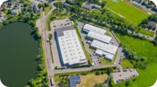
Precision, Reliability, and Speed You Can Count on

Since 1991, Aero Photo has been  the trusted partner for aerial photography across the Southeastern United States. Our fleet of Cessna aircraft and certified drone operators deliver unmatched precision and on-time results for every project.

FAA Certified & Insured

Licensed pilots and drone operators ensuring complete safety and regulatory compliance.

On-Time Delivery Guaranteed

Fast turnaround times with reliable scheduling to keep your projects on track.

Engineering grade precision

High-resolutions imagery and accurate mapping for technical applications.

Serving the Southeastern United States

Regional Coverage with local expertise accross 9 states

Florida

Comprehensive aerial coverage statewide

Georgia

Atlanta metro and beyond

Alabama

Full state aerial services

Mississippi

Complete regional coverage

Louisiana

Gulf Coast to inland regions

South Carolina

Charleston to Columbia coverage

North Carolina

Mountains to coast service

Tennesse

Nashville, Memphis & statewide

Texas

Texas Hill Country & beyond

Maryland

Baltimore & Coastal Areas

Illinois

Inland charm & farmland

Ohio

Cleveland to Cincinnati

Oklahoma

Aerial coverage statewide

Virgina

Historic sites and scenic mountains

Missouri

Rivers, forests, and heartland cities

Kentucky

Aerial and ground coverage statewide

Connect with regional representatives for local expertise

Ready to See Your Project from a New Perspective?